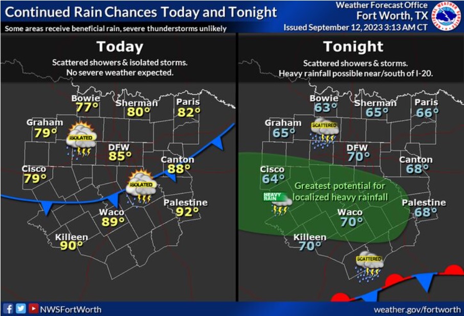
Rain chances will continue across the area today, although there will be fair amount of dry time during the day. Highs will mostly be in the upper 70s and 80s, although a few locations in Central Texas will be able to reach 90. Higher rain chances will exist overnight into early Wednesday morning, with a threat for locally heavy rainfall near and south of the I-20 corridor.
Tuesday
A 40 percent chance of showers and thunderstorms before 1pm. Mostly cloudy, with a high near 86. North northeast wind 5 to 10 mph.
Tuesday Night
Showers and thunderstorms likely, mainly after 4am. Mostly cloudy, with a low around 71. North northeast wind 5 to 10 mph. Chance of precipitation is 60%. New rainfall amounts of less than a tenth of an inch, except higher amounts possible in thunderstorms.
Wednesday
Showers and thunderstorms likely, mainly before 10am. Cloudy, with a high near 83. Northeast wind 5 to 10 mph. Chance of precipitation is 60%.
Wednesday Night
A 50 percent chance of showers and thunderstorms. Mostly cloudy, with a low around 70. East wind around 5 mph.
Thursday
Showers likely and possibly a thunderstorm. Mostly cloudy, with a high near 82. East southeast wind 5 to 10 mph. Chance of precipitation is 70%.
Thursday Night
Showers likely and possibly a thunderstorm. Mostly cloudy, with a low around 68. East wind around 10 mph. Chance of precipitation is 70%.
Friday
A 40 percent chance of showers and thunderstorms. Mostly cloudy, with a high near 83. East wind around 10 mph.
Friday Night
A 50 percent chance of showers and thunderstorms. Mostly cloudy, with a low around 69. East wind 5 to 10 mph becoming north after midnight.
Saturday
A 40 percent chance of showers and thunderstorms, mainly before 1pm. Partly sunny, with a high near 84.