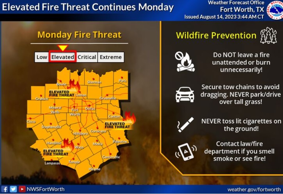
Due to hot temperatures and abundant dry fuel. Today will be a bit cooler and more humid in many areas which should keep the fire threat from becoming critical as ERCOT officials also extend its Weather Watch
Texas (WBAP/KLIF) – ERCOT extended a weather watch on Friday through Friday of this week due to continued extreme temps and higher demand for electricity.
In a tweet, “ERCOT said that it “continues to monitor conditions closely and will deploy all available tools to manage the grid, continuing a reliability-first approach to operations.” Officials say grid conditions are expected to be normal during the weather watch.
Meantime, you can get grid condition notifications through the Texas Advisory and Notification System (TXANS) or monitor in real time at ercot.com.
___
FORECAST:
Today
Sunny and hot, with a high near 100. Heat index values as high as 106. Southwest wind 5 to 15 mph becoming north in the afternoon. Winds could gust as high as 20 mph.
Tonight
Mostly clear, with a low around 76. North northeast wind 10 to 15 mph, with gusts as high as 20 mph.
Tuesday
Sunny, with a high near 95. North northeast wind 5 to 10 mph, with gusts as high as 20 mph.
Tuesday Night
Clear, with a low around 70. East northeast wind 5 to 10 mph.
Wednesday
Sunny, with a high near 97. East wind around 5 mph.
Wednesday Night
Clear, with a low around 75. East wind 5 to 15 mph becoming south southeast after midnight. Winds could gust as high as 20 mph.
Thursday
Sunny and hot, with a high near 106. South wind around 10 mph.
Thursday Night
Mostly clear, with a low around 82. Southeast wind 10 to 15 mph, with gusts as high as 20 mph.
Friday
Sunny and hot, with a high near 107. South southwest wind around 10 mph.
Friday Night
Clear, with a low around 82.