Storms are expected ahead of incoming cold front during Friday evening and into Saturday morning.
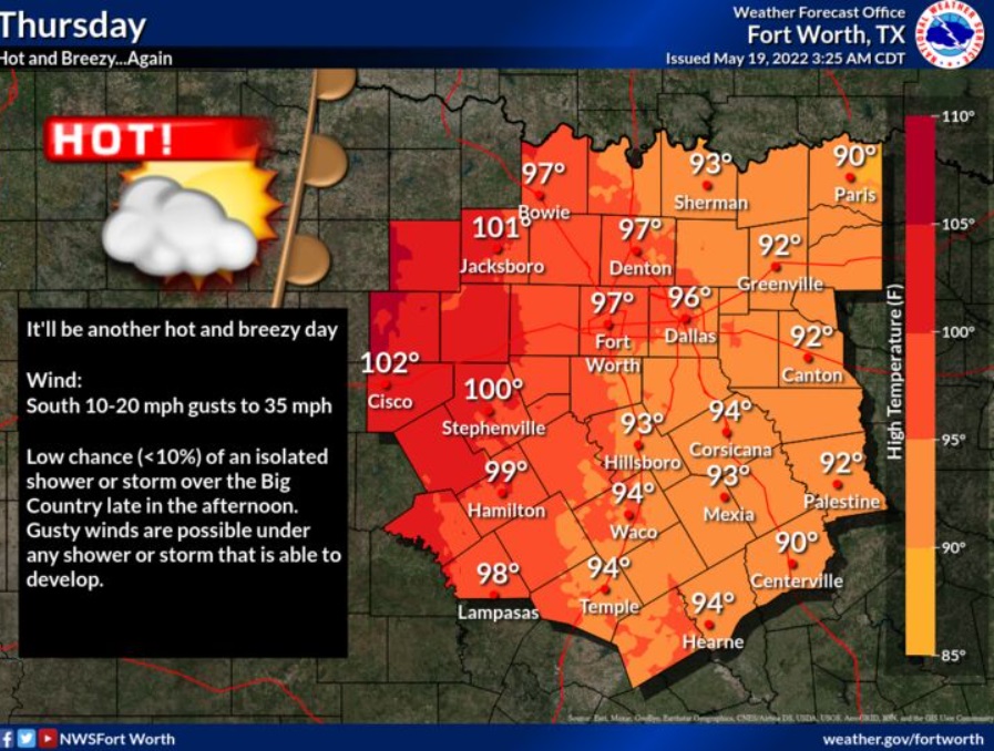
Thursday: Sunny, with a high near 96. South wind between 14 and 21 mph, with gusts as high as 29 mph.
Thursday Night: Increasing clouds, with a low around 73. Breezy, with a south wind between 17 and 22 mph, with gusts as high as 31 mph.
Friday: Mostly cloudy, then gradually becoming sunny and hot, with a high near 97. South wind between 15 and 21 mph, with gusts as high as 28 mph.
Friday Night: Partly cloudy, with a low around 75. South wind between 17 and 21 mph, with gusts as high as 28 mph.
Saturday: A 30 percent chance of showers and thunderstorms after 1pm. Mostly sunny, with a high near 94.
Saturday Night: A 50 percent chance of showers and thunderstorms. Mostly cloudy, with a low around 61.
Sunday: Mostly cloudy, with a high near 74.
Sunday Night: Mostly cloudy, with a low around 65.
Monday: Showers likely. Mostly cloudy, with a high near 78.
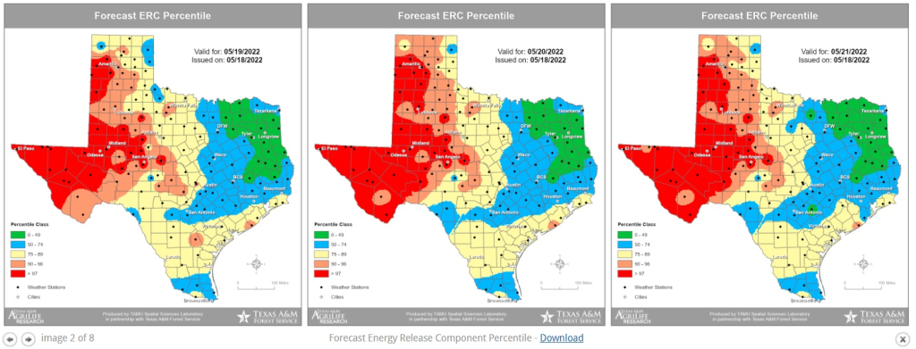
Meantime, the fire danger warning for parts of central and west Texas is either high or extremely high.
(Copyright 2022 WBAP/KLIF. All rights reserved.)