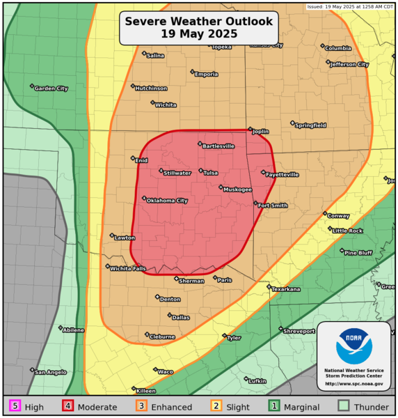
FORT WORTH – (WBAP/KLIF)- Significant severe weather is likely from the central/southern Plains into the the Ozarks today into tonight. All severe weather hazards are expected, to include tornadoes (some potentially strong to intense), very large hail, and severe winds.
More storm chances are in the forecast for North Texas and throughout the DFW Metroplex, beginning mid-afternoon and lasting at least through the earlier evening hours. Storms could once again become severe, spawning large hail, damaging winds and the possiblity of tornadoes forming. Significant severe weather continues from the central and Southern Plains into the Ozarks today through this evening.
(Copyright, All Rights Reserved, WBAP/KLIF 2025)