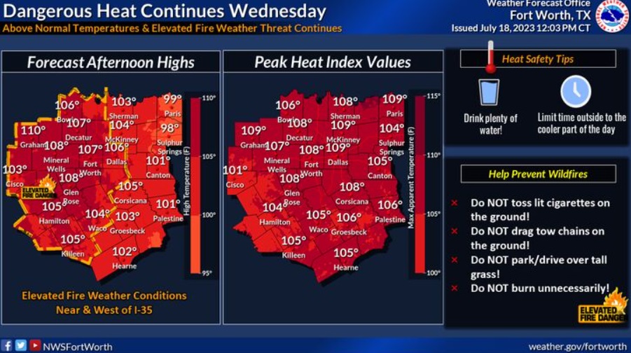
Elevated fire weather conditions will also exist for areas near and west of the I-35 corridor. Continue to take the necessary precautions against the oppressive heat to limit heat related illnesses.
EXCESSIVE HEAT WARNING REMAINS IN EFFECT UNTIL 8 PM

Extreme heat and humidity will significantly increase the potential for heat related illnesses, particularly for those working or participating in outdoor activities.  Anyoneovercome by heat should be moved to a cool and shaded location.
Heat stroke is an emergency! Call 9 1 1.


Forecast:
Wednesday
Sunny and hot, with a high near 105. South wind 10 to 15 mph, with gusts as high as 20 mph.
Wednesday Night
Mostly clear, with a low around 80. South wind 10 to 15 mph, with gusts as high as 20 mph.
Thursday
Mostly sunny and hot, with a high near 103. Heat index values as high as 107. South southwest wind around 10 mph.
Thursday Night
Mostly clear, with a low around 80. South southeast wind around 10 mph.
Friday
Partly sunny and hot, with a high near 101. South southwest wind around 10 mph becoming north northwest in the afternoon.
Friday Night
Partly cloudy, with a low around 76. East northeast wind around 10 mph.
Saturday
Mostly sunny, with a high near 95. North northeast wind around 10 mph.