Severe thunderstorms may develop late on Thursday ahead of an advancing dryline, with more strong to severe storms accompanying a cold front moving through the area later Thursday night into Friday. Potential hazards include large hail, damaging winds, and a few tornadoes, mainly north of Interstate 20/30.
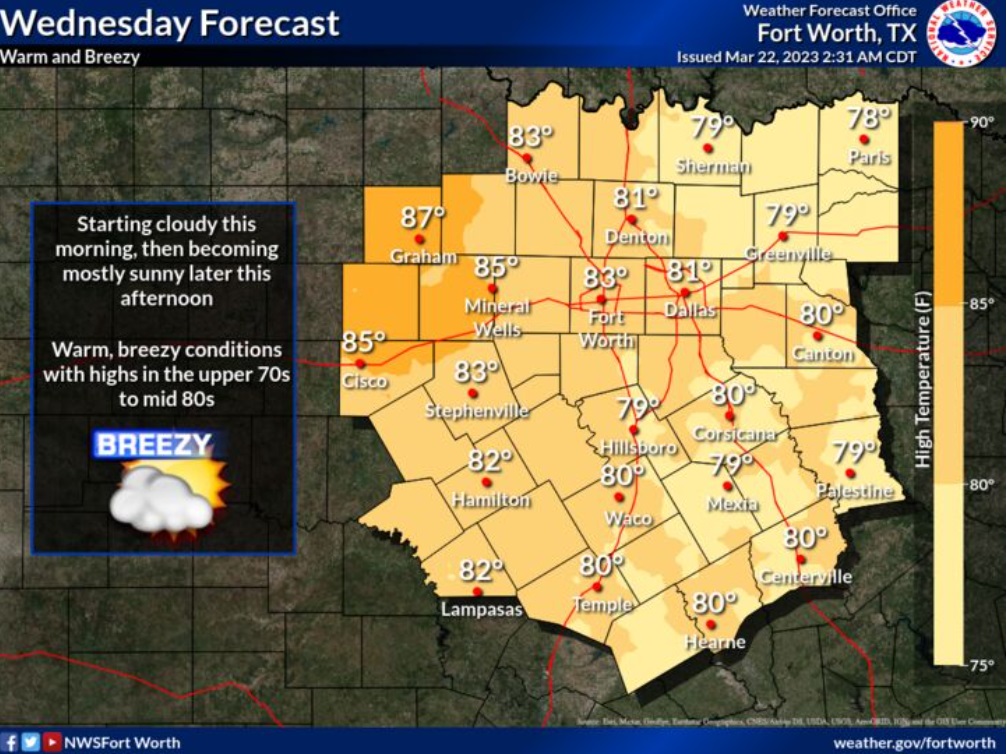
Wednesday
Mostly cloudy, with a high near 81. South wind 15 to 20 mph, with gusts as high as 30 mph.
Wednesday Night
Increasing clouds, with a low around 67. South wind 15 to 20 mph, with gusts as high as 30 mph.
Thursday
A 30 percent chance of showers and thunderstorms after 2pm. Mostly cloudy, with a high near 82. South wind 15 to 20 mph, with gusts as high as 30 mph.
Thursday Night
Showers and thunderstorms likely, mainly after 2am. Mostly cloudy, with a low around 65. South wind around 20 mph, with gusts as high as 30 mph. Chance of precipitation is 70%.
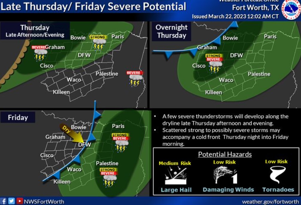
Friday
Showers and thunderstorms likely, mainly before 8am. Partly sunny, with a high near 79. Southwest wind 15 to 20 mph, with gusts as high as 30 mph. Chance of precipitation is 70%.
Friday Night
Mostly clear, with a low around 54. West southwest wind 15 to 20 mph, with gusts as high as 25 mph.
Saturday
Sunny, with a high near 75. West wind around 10 mph, with gusts as high as 20 mph.
Saturday Night
Mostly clear, with a low around 53. Southwest wind around 10 mph becoming east southeast in the evening.
Sunday
A chance of showers and thunderstorms between 8am and 2pm, then a slight chance of showers after 2pm. Partly sunny, with a high near 77. Chance of precipitation is 30%.