These storms could start early in the morning (as early as 7 AM) and would continue through midday while affecting the I-20 and I-30 corridors: severe storms Thursday.
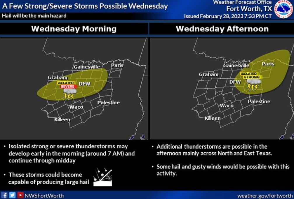
Wednesday
A chance of showers and thunderstorms before 9am, then showers likely and possibly a thunderstorm between 9am and 3pm, then a chance of showers and thunderstorms after 3pm. Cloudy, with a high near 76. South southwest wind 5 to 10 mph, with gusts as high as 20 mph. Chance of precipitation is 70%. New rainfall amounts between a tenth and quarter of an inch, except higher amounts possible in thunderstorms.
Wednesday Night
A 20 percent chance of showers and thunderstorms. Mostly cloudy, with a low around 64. South southeast wind 5 to 15 mph, with gusts as high as 25 mph.
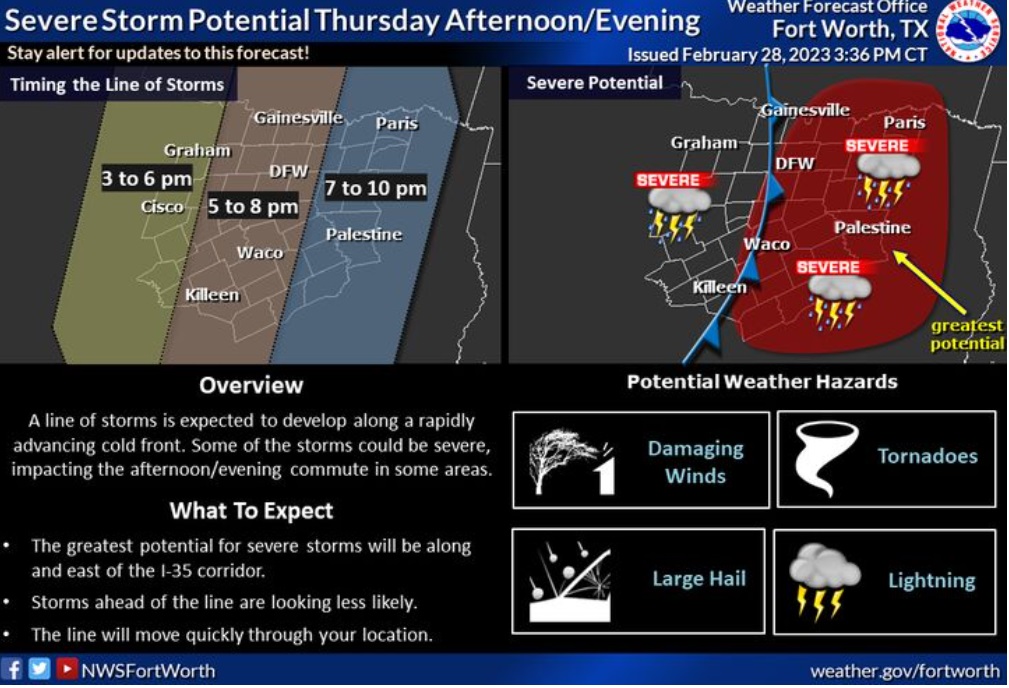
Thursday
Showers and possibly a thunderstorm. Some of the storms could be severe. High near 78. South wind 15 to 20 mph, with gusts as high as 30 mph. Chance of precipitation is 80%.
Thursday Night
Showers and possibly a thunderstorm before 9pm, then showers between 9pm and midnight, then a slight chance of showers and thunderstorms after midnight. Some of the storms could be severe. Low around 42. Windy, with a west wind 15 to 20 mph increasing to 25 to 30 mph after midnight. Winds could gust as high as 50 mph. Chance of precipitation is 80%.
Friday
Sunny, with a high near 60. Breezy, with a west northwest wind 20 to 25 mph decreasing to 15 to 20 mph in the afternoon. Winds could gust as high as 45 mph.
Friday Night
Clear, with a low around 43. Northwest wind 5 to 10 mph becoming southeast after midnight.
Saturday
Sunny, with a high near 67. South southeast wind 10 to 15 mph becoming north northwest in the afternoon. Winds could gust as high as 20 mph.