Some dangerously hot weather on the way…
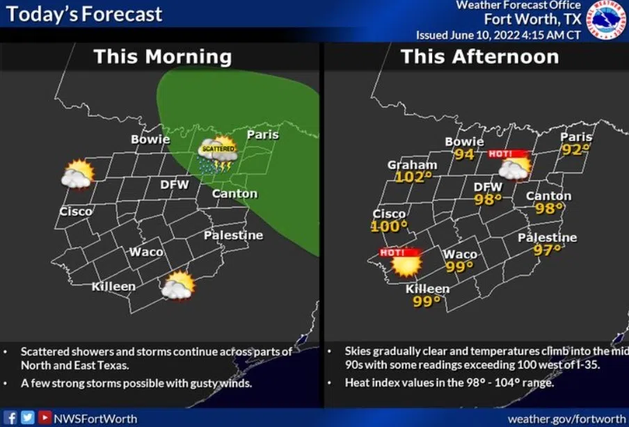
Today| Cloudy early…(complex of rain and storms north…may clip northern counties…) then A mix of clouds and sun. Near record high temperatures. High 99F. (RECORD is 101) Winds SSW at 10 to 20 mph.
Tonight |Partly cloudy. Low 79F. Winds S at 10 to 15 mph.
Tomorrow| Mostly sunny skies. Near record high temperatures. High 103F. (RECORD IS 103) Winds SSW at 10 to 15 mph.
Tomorrow night| Clear skies. Low 81F. Winds S at 10 to 20 mph.
Sunday| Sunny. Highs 100 to 104F (RECORD IS 103)
and lows in the upper 70s.
Monday| Abundant sunshine. Highs in the upper 90s and lows in the upper 70s.
Tuesday| Mostly sunny and windy. Highs in the upper 90s and lows in the mid 70s.
Wednesday| More sun than clouds. Highs in the upper 90s and lows in the upper 70s.
Thursday| Mostly sunny. Highs in the upper 90s and lows in the upper 70s.